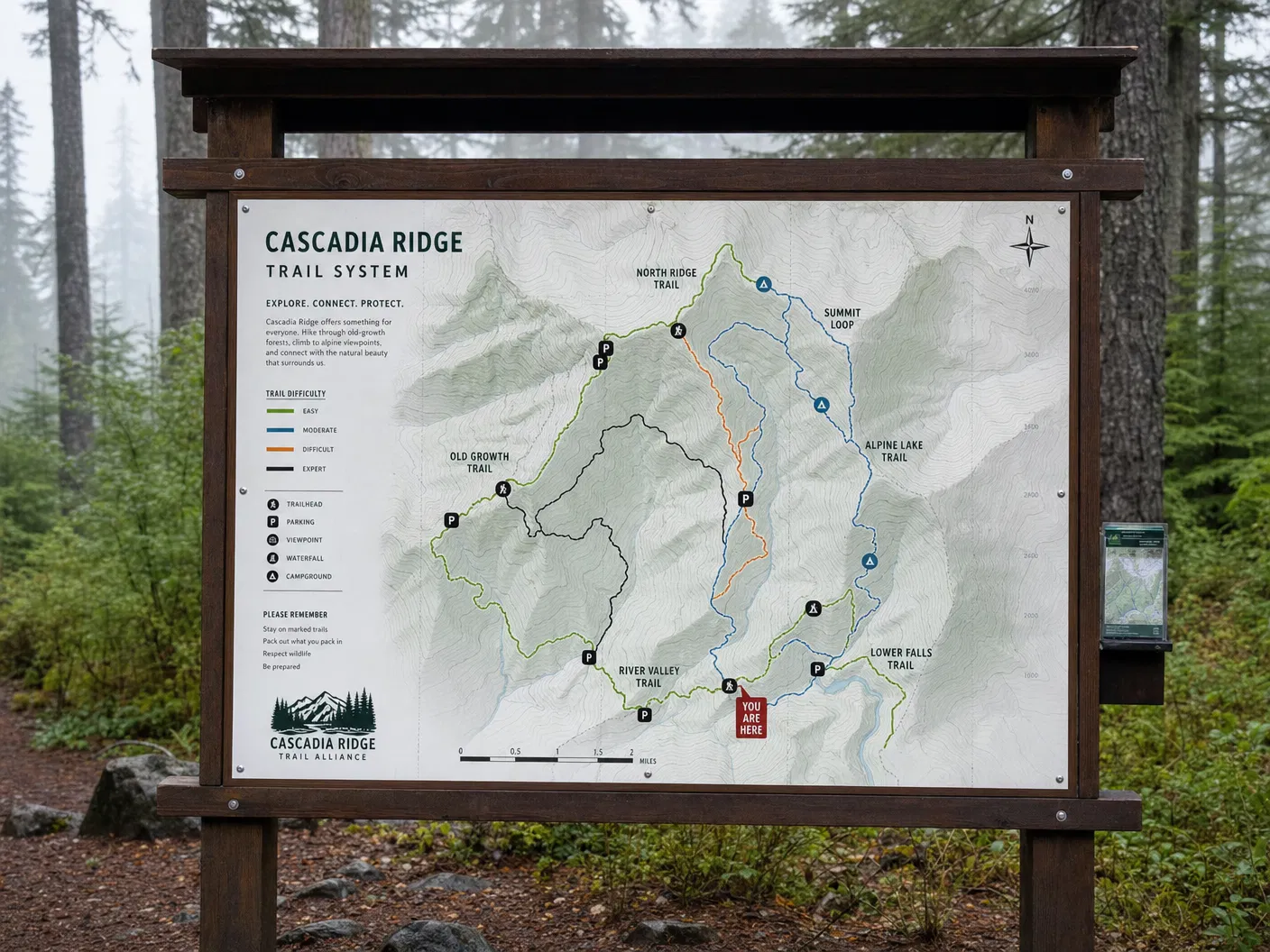
Map Product
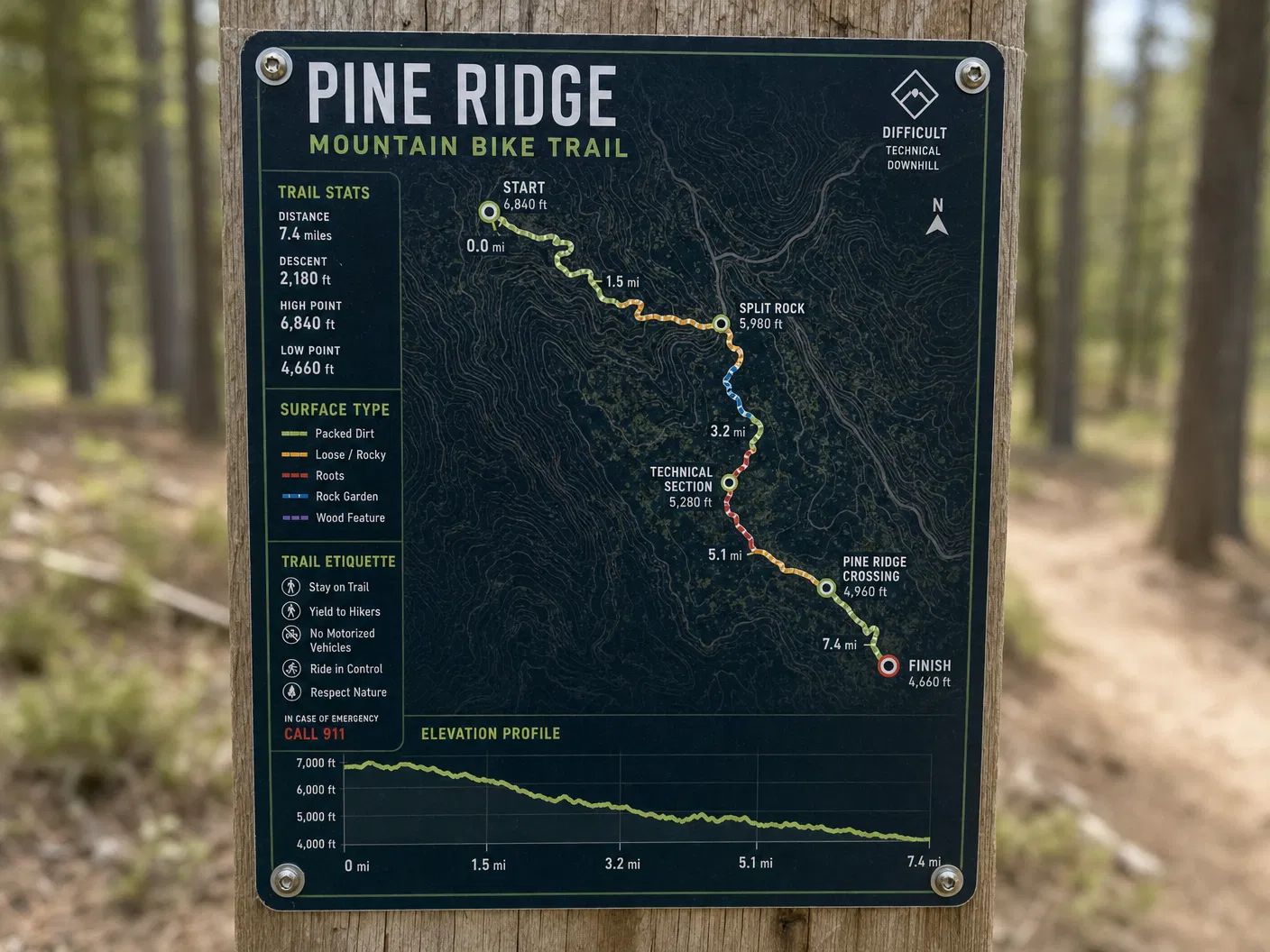
Single Trail Corridor Map
Starting from$145.00
Detailed map of a single trail with elevation profile, surface type, waypoints, and distance markers.
Configure Your Map
Single Trail Corridor Map
Premium archival paper prints — the most popular choice.
Select Product
Type
Size
Quantity
1
Current Selection
Prints · Photographic · 16" × 20"
$44.00
Available Sizes16×20" or 18×24"
FormatsPrint / Digital PDF
AvailabilityIn Stock
Free ShippingOrders over $150
Secure PackingDamage-free delivery
Satisfaction30-day guarantee
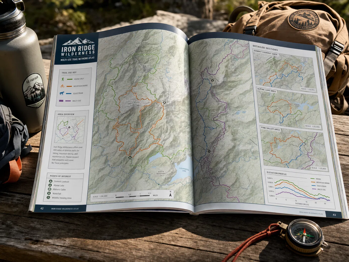
About This Map
A detailed corridor map for a single trail — ideal for signature routes, interpretive trails, or any trail where users need rich detail. Features the trail alignment at high resolution with elevation profile, surface type, waypoints, distance markers, and points of interest.