Featured
Featured Map
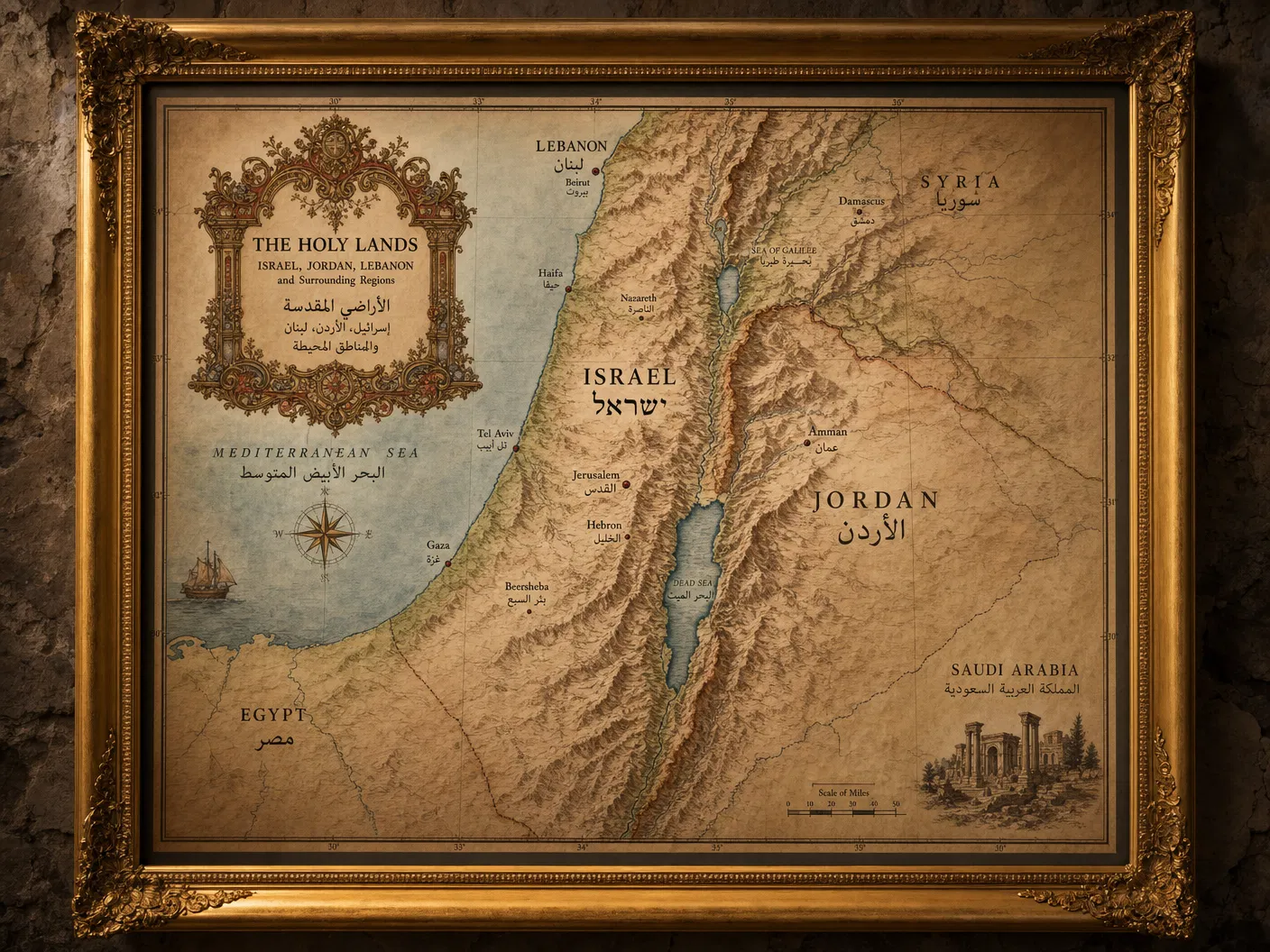
The Holy Lands — Master Map
Starting from$285.00
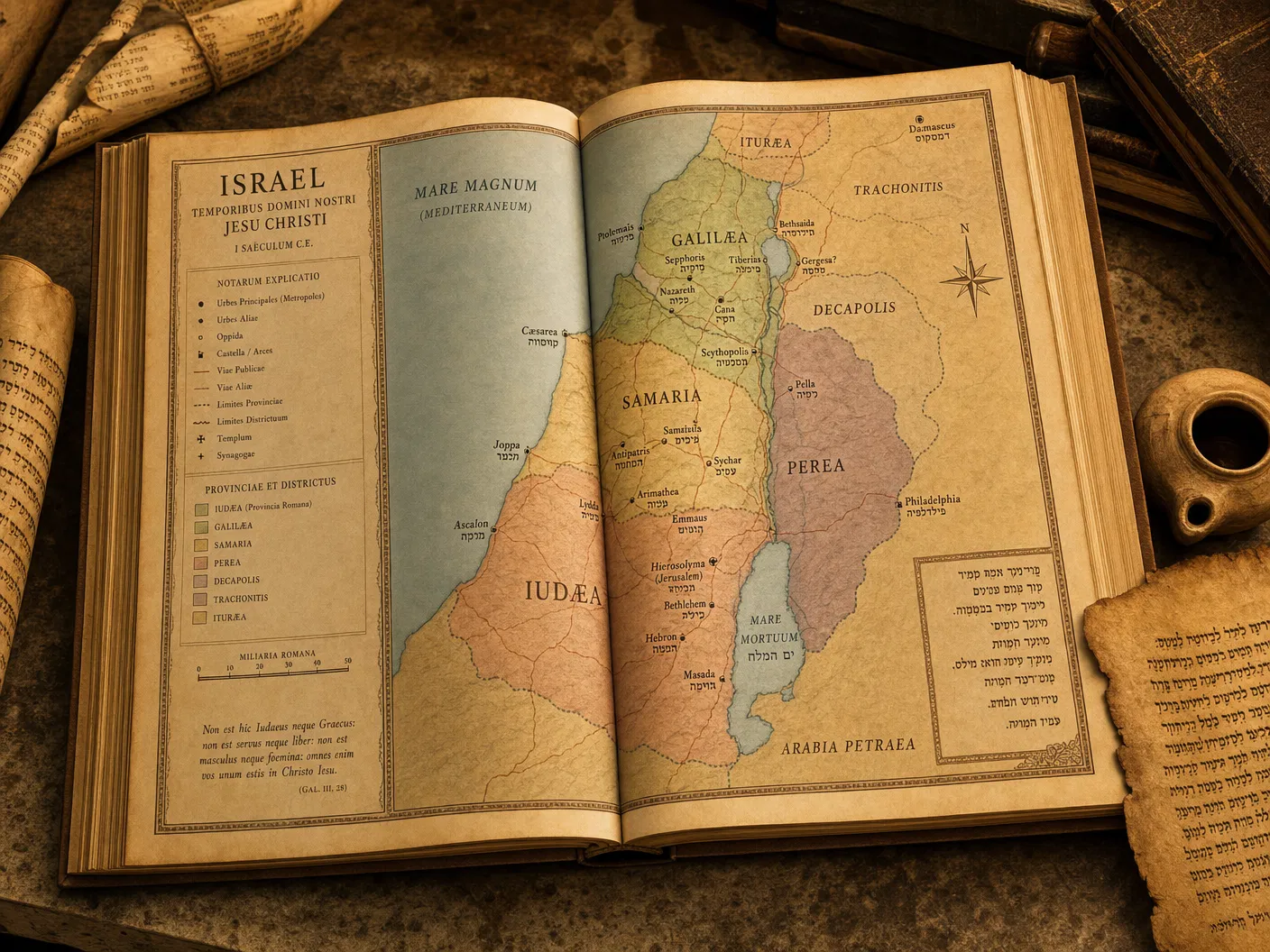
Our signature piece: richly detailed map of Israel, Jordan, Lebanon, and surrounding regions in the classical cartographic tradition.
Configure Your Map
The Holy Lands — Master Map
Premium archival paper prints — the most popular choice.
Select Product
Type
Size
Quantity
1
Current Selection
Prints · Photographic · 16" × 20"
$44.00
Available Sizes24×36", 36×48", or Museum Print
FormatsArchival Matte / Museum Giclée on Cotton Rag
AvailabilityIn Stock
Free ShippingOrders over $150
Secure PackingDamage-free delivery
Satisfaction30-day guarantee
About This Map
The crown jewel of our Historical Cartography series. This signature map depicts the Holy Lands — Israel, Jordan, Lebanon, the Palestinian territories, and surrounding regions — with the richness and detail of the classical cartographic tradition, grounded in modern GIS accuracy. Rendered in warm parchment tones with hand-lettered place names, topographic shading, and decorative borders.