Map Product
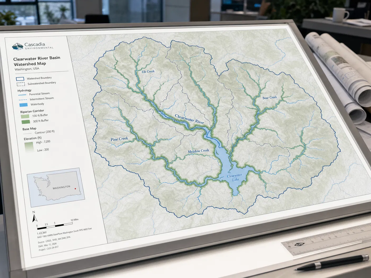
Watershed & Riparian Corridor Maps
Starting from$295.00
Detailed mapping of watershed boundaries, stream networks, floodplains, and riparian buffers.
Configure Your Map
Watershed & Riparian Corridor Maps
Premium archival paper prints — the most popular choice.
Select Product
Type
Size
Quantity
1
Current Selection
Prints · Photographic · 16" × 20"
$44.00
Available SizesCustom
FormatsPrint / GIS Data / Interactive Web
AvailabilityIn Stock
Free ShippingOrders over $150
Secure PackingDamage-free delivery
Satisfaction30-day guarantee
About This Map
Comprehensive watershed mapping products for conservation organizations, municipalities, and environmental consultants. Each map delineates watershed boundaries, stream order and network, floodplain extents, riparian buffer zones, and key hydrological features.